Map searching
The Map Search screen appears in another tab of your browser when you choose Map on the menu bar.
The map opens at a default location defined by your authority. You can click-and-drag to scroll the map, and use the  Zoom in and
  Zoom out tools to change the scale.
The  Line distance and
  Radius distance tools enable you to measure distances between and around points. These shapes are removed by the
  Clear all tool.
Note
If you open the Map Search screen while you are working on an application, worksheet or other record, you can use the  Draw Polygons tool to define the site boundary and the
  Save Plotted Boundary to Database tool to keep it.
Searching for addresses
-
Click
 to open the Find Address control.
 -
Start typing a full address, a house number with a postcode, or a UPRN in the Find address ... box.
ASSURE offer potential matches as you do so.
-
Double-click each one you want. You can select up to five addresses in this way.
-
Click
 again.
The map adjusts to show the selected addresses, which are marked by pins.
Only in-area, open properties and organisations can be found by this method.
Advanced searching
Use advanced searching to find ASSURE Land & Property applications and other records at the selected addresses, or at your current position as identified by geolocation.
-
Open the ADVANCED SEARCH panel and specify your criteria.
Fields in the Advanced Search panel  Advanced Search criteria
Description
Use My Current Location
Whether to use geolocation to find the address.
Select Address Type
Whether to search for a registered address or the site address:
-
There may be multiple registered addresses relating to the application.
-
The site address is the description of the site location relative to the registered addresses. Typically this is the first registered address.
Select Address or UPRN
The address itself or its UPRN. After at least three characters, ASSURE starts listing suggested addresses.
Select application type or types
Whether to search for Planning, Planning Enforcement, or Planning Appeal applications (in any combination).
Select a status
The required statuses of the selected applications; for example: Registered or Withdrawn.
Select a date
When the applications were received; this can be either a predefined time period or a custom date range.
Sort by
Whether to sort results in chronological order or by the date received.
-
-
Click Search.
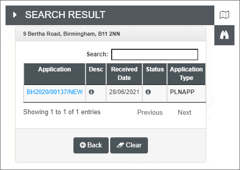
Any found applications are listed in a
 SEARCH RESULT panel.
 -
Click any linked Application number to open that application.

Spatial searching on layers
Spatial searching on layers is currently available only for ASSURE Land & Property. It starts with an area on the map (although a marker is also possible) and searches for coincident features; that is, features in various layers that are either wholly within, or overlap, the search area.
There are three ways to specify the search area:
-
New polygon: You simply draw the area within which you want to search.
-
Current selection: Select TOIDs, or draw and select polygons or circles.
-
Current item: If the map is opened in the context of a Land & Property application, the application's site boundary is assumed to be the search area.
You can either search all layers (except those that have been explicitly excluded from spatial search), or select which layers you want by using the overlay menus. Searching all layers may take some time.
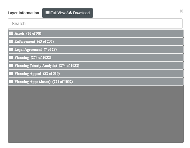
When the search is complete, the Layer Information panel opens summarising the results. Each layer's features are grouped separately.

Click the Full View / Download button to open the Spatial Search - Full View screen. This screen lists all the results and allows you to download all or selected layers to your device as a PDF file.
Searching against a drawn polygon
-
Click the
 Spatial Search on Layers tool.
 -
In the Search With field, select New Polygon.
-
In the Search Where field:
-
Select All to search all available layers.
-
Select Advanced to display the overlay menu, then tick which of the available layers you want to search.
-
-
Click Search.
-
Draw the polygon.
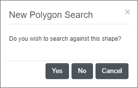
After completing the polygon, ASSURE asks whether you want to search against it.

-
Click Yes to continue, or No if you want to redraw the polygon.
Searching against the current selection
This is possible only if you have opened the map while working on a plotted application or record.
-
Select TOIDs (if
 enabled) or use the
  Draw Polygons or
  Draw Circle or
  Draw Marker tools to draw one or more areas and points.
 -
Right-click on each area or point and choose Select.
-
Click the
 Spatial Search on Layers tool.
 -
In the Search With field, select Current Selection.
-
In the Search Where field:
-
Select All to search all available layers.
-
Select Advanced to display the overlay menu, then tick which of the available layers you want to search.
-
-
Click Search.
Searching against the current application's site boundary
This is possible only if you have opened the map while working on a plotted application or record. The site boundary may comprise multiple polygons, not necessarily adjacent to one another.
-
Click the
 Spatial Search on Layers tool.
 -
In the Search With field, select Current Item [Application Number].
-
In the Search Where field:
-
Select All to search all available layers.
-
Select Advanced to display the overlay menu, then tick which of the available layers you want to search.
-
-
Click Search.