Map codes to geographical areas
Certain code types that describe geographical areas can be mapped to the areas that are returned by a layer.
-
On the System Administration screen, click .
The GIS Administration screen appears.
-
Click .
The Geometry Mapping for CODEs screen appears.
-
In the side panel, enter the WFS Layer Name of the layer that will provide the boundaries. The name is case-sensitive.
For example: nps:GIS_OVERLAY_WARD.
-
Click to load the layer into the map.
-
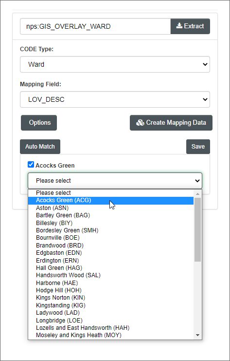
In the CODE type field, select the type of geographical area:
-
Ward
-
Parish
-
Constituency
-
Management Area (but see the Note below)
-
-
In the Mapping Field list, select which property of the layer you want to map to the code type.
For example: LOV_DESC.
-
Click .
The panel shows, for each area defined in the layer, a checkbox for the value of the mapping field for that area and a list of valid descriptions (and codes) from the selected code type.
-
To map areas to codes manually, for each area in turn:
-
Click the area's checkbox to highlight it on the map.
-
Select the code /description that matches this area.
Alternatively, you can click and confirm, to attempt to match areas to codes automatically.
-
-
Click .
Note
You can also map management areas directly, by editing the Management Area Codes code type; in fact this may be easier.